Trail of Eaux Blanches
1 point of interest

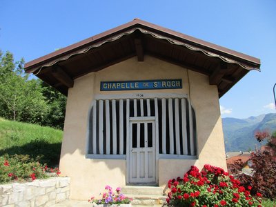
La chapelle Saint Roch de Saint Oyen - CCVA  Small heritage
Old village of Saint Oyen
The pretty village of Saint-Oyen nestles on the left sloping banks of the Morel, a tributary of the River Isère, at an altitude of 586m. It is named after its patron saint Eugendus (Oyend in French); this applies for the three villages of Saint-Oyen in the Aosta Valley, Saint-Oyens in the canton of Vaud and Saint-Oyen in the Tarentaise area. It overlooks Aigueblanche basin. Steeped in a rich past and a longstanding tradition in these Alpine valleys, the village boasts two chapels, Saint-Roch and Notre-Dame-du-Puits, and a Baroque-style church (17th century).
Description
Start from the Bellecombe Bridge, left river bank of the Isère, in the village of Grand-Aigueblanche (460m).
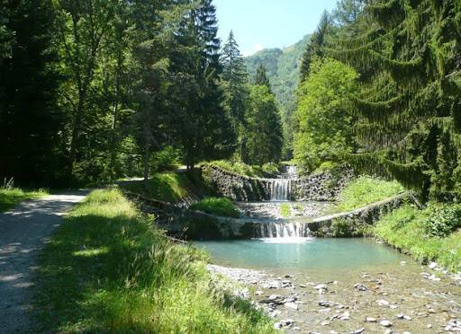
Warm up on a 2km flat path along the Isère, going upstream. The path then goes slightly uphill, past the small flood dams built to protect the towns in 1905.
The signposts won’t take you all the way to the viewpoint above the Morel waterfall but it’s only a 5 minute detour to appreciate its natural beauty and the first human interventions to fight against a once deadly torrent.
A short path (200m) then takes you through St-Oyen, hamlet of Grand-Aigueblanche. Once on the other side, you’ll arrive in the Bois Chaniet woods.
The quick downhill passage will bring you to the thermal resort of La Léchère-les-Bains and then through the garden, past the oriental style buildings.
Join back up with the Isère on a final flat stretch to the Morel leisure centre and back to the starting point.
- Departure : Grand-Aigueblanche, Bellecombe Bridge
- Arrival : Grand-Aigueblanche, Bellecombe Bridge
- Towns crossed : AIGUEBLANCHE, SAINT-OYEN, and LA LECHERE
Altimetric profile
Access and parking
From Albertville, RN90 (exit 37), RD97 (through La Léchère), then RD97A (through Bellecombe), then RD94 until the Isère Bridge where there’s a car park right before the bridge.
From Moûtiers, RN90 (exit 38), RD92 (through Aigueblanche), then RD94 (Isère bridge) where there’s a car park right after the bridge.
Parking :
Accessibility
- Emergency number :
- 114
Report a problem or an error
If you have found an error on this page or if you have noticed any problems during your hike, please report them to us here:
